
Subscription
Stock Illustration: Singapore and southern Strait of Malacca, gray political map. Malacca Strait and Singapore Strait connecting Indian Ocean with South China Sea, a geostrategic choke point for global shipping. Vector
Item number : 140129901 See all
This Stock Illustration, whose title is "Singapore and southern Strait of Malacca, gray..."[140129901], includes tags of map, infographic, vector. The author of this item is Peter Hermes Furian (No.362672). Sizes from S to XL including Vector are available and the price starts from US$5.00. You can download watermarked sample data (comp images), check the quality of images, and use Lightbox after signing up for free. See all
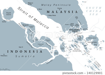
Singapore and southern Strait of Malacca, gray political map. Malacca Strait and Singapore Strait connecting Indian Ocean with South China Sea, a geostrategic choke point for global shipping. Vector
Scale
* You can move the image by dragging it.


Credits(copyright) : Peter Hermes Furian / PIXTA
- About Model and Property Release
- Views : 50
- Past purchases : No
- Contact Contributor to Ask About This Item