Subscription

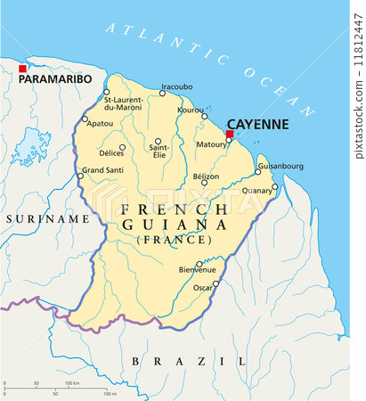
Stock Illustration: French Guiana Political Map

Item number : 11812447 See all

This Stock Illustration, whose title is "French Guiana Political Map"[11812447], includes tags of cayenne, france, map. The author of this item is Peter Hermes Furian (No.362672). Sizes from S to XL including Vector are available and the price starts from US$5.00. You can download watermarked sample data (comp images), check the quality of images, and use Lightbox after signing up for free. See all

French Guiana Political Map 11812447

French Guiana Political Map

  • 1:1
  • 4:3
  • 4:5
    (8:10)
  • 3:2(6:4)
  • Custom
    :

Scale

* You can move the image by dragging it.

S
  • 557 x 640px
  • 19.6 x 22.6cm (72dpi)
JPG US$5.00
M
  • 1740 x 2000px
  • 14.7 x 16.9cm (300dpi)
JPG US$15.00
L
  • 3481 x 4000px
  • 29.5 x 33.9cm (300dpi)
JPG US$30.00
XL
  • 6000 x 6894px
  • 50.8 x 58.4cm (300dpi)
JPG US$50.00
V Vector EPS US$35.00
Ex Add an Extended License +US$30.00
Total :
Design with this image

With this editor tool,
you can create a design with PIXTA items before purchasing.
Click here for details.

Stock Illustration: French Guiana Political Map tags

Description / Comment
French Guiana Political Map with capital Cayenne, national borders, most important cities, rivers and lakes. Illustration with English labeling and scaling.