Subscription

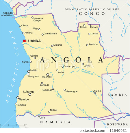
Stock Illustration: Angola Political Map

Item number : 11640981 See all

This Stock Illustration, whose title is "Angola Political Map"[11640981], includes tags of luanda, cabinda, angola. The author of this item is Peter Hermes Furian (No.362672). Sizes from S to XL including Vector are available and the price starts from US$5.00. You can download watermarked sample data (comp images), check the quality of images, and use Lightbox after signing up for free. See all

Angola Political Map 11640981

Angola Political Map

  • 1:1
  • 4:3
  • 4:5
    (8:10)
  • 3:2(6:4)
  • Custom
    :

Scale

* You can move the image by dragging it.

S
  • 640 x 626px
  • 22.6 x 22.1cm (72dpi)
JPG US$5.00
M
  • 2000 x 1956px
  • 16.9 x 16.6cm (300dpi)
JPG US$15.00
L
  • 4000 x 3913px
  • 33.9 x 33.1cm (300dpi)
JPG US$30.00
XL
  • 6133 x 6000px
  • 51.9 x 50.8cm (300dpi)
JPG US$50.00
V Vector EPS US$35.00
Ex Add an Extended License +US$30.00
Total :
Design with this image

With this editor tool,
you can create a design with PIXTA items before purchasing.
Click here for details.

Stock Illustration: Angola Political Map tags

Description / Comment
Political map of Angola with capital Luanda, with national borders, most important cities, rivers and lakes. Vector illustration with English labeling and scaling.